Flood Risk is Minimal at Westmont
Brett Gracely ’90, a water resource engineer with Matrix Design Group, assessed the potential for flooding on Westmont’s campus and reassured emergency officials that expected rainfall will not severely impact campus. Campus officials consulted with Gracely and county officials carefully considering all options before deciding to implement Westmont’s SAFE plan (Shelter Activated for Flood Emergencies). During the rainstorm, students are not required to leave campus despite the county's mandatory evacuation order because it has been deemed a safe place.
"While all conditions cannot be reasonably anticipated, recent experience and the condition of the upland Chelham watershed and channel indicate that the risk of flooding through campus is not greater than prior to the Thomas fire," Gracely says.
Gracely, a certified hydrologist, considered several factors including campus staff’s contact with county emergency officials, a well maintained and protected channel through campus, upstream vegetation to slow rainfall, the size of the basin that feeds the channel and recent flood events on campus.
He noted that Westmont’s administration is in close contact with Santa Barbara County Emergency Management and Flood Control as they continue to disseminate information about the storm and the flooding conditions in the area, as well as monitoring the National Weather Service about the rainfall intensity.
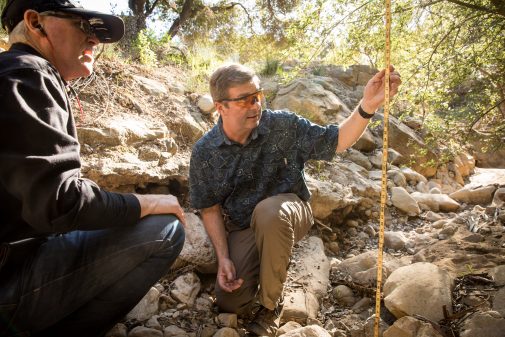
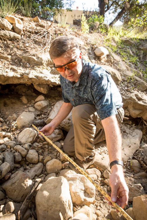
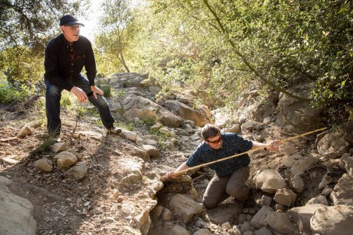
Gracely and Troy Harris, assistant vice president for institutional resilience, started in the middle of campus and walked the entire channel that leads from the upstream basin to the western end of the Thomas Fire burn area.
“The channel upstream is very well maintained,” Gracely says. “There is not a lot of debris, in terms of vegetative or woody debris, that would make its way down into the campus. Much of that channel upstream is channelized and protected with rock riprap. And the underpasses beneath La Paz Road and East Mountain Drive are in good condition and will pass water freely.”
In terms of the upstream contributing watershed, he consulted official maps above the Thomas Fire area as well as the relative watershed areas upstream of Westmont to compare to areas further east in Montecito that severely flooded in January. “There are approximately 440 square miles of burn area according to the USGS and their debris flow hazard mapping indicates the basin immediately above Westmont has about a 0-to-20 percent probability of creating a debris flow after the fire,” he says. “For comparison, the basins to the east of campus, the Cold Spring Canyon, San Ysidro Canyon and Romero Canyon, mapping shows a 60-to-80 percent probability of a debris flow.”
It bears noting that the little-burned basin draining across the campus is only about 200 acres, compared to the 10,000 acres to the east of Westmont where the Jan. 9 debris flow occurred.
The difference is primarily due to how severe the Thomas Fire burned in those upstream basins. “That terrain above Montecito was described as a moonscape, meaning all the vegetation there burned to ash and exposed the sandy soils beneath that,” Gracely says. “Part of the Chelham Creek basin, upstream of Westmont, had burned in the 2008 Tea Fire. So, the amount of fuel on that watershed was much less and the Thomas Fire didn’t burn as hot.”
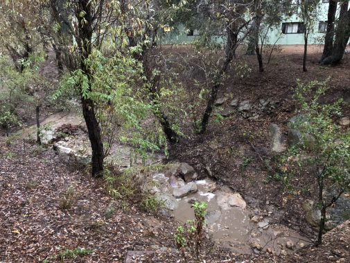
Gracely and Harris noticed a lot of green vegetation remaining in the basin above Westmont, including a range of grasses, chaparral shrubs and coast live oaks.
“All those lead to reduced risk of high-intensity water flow as well as debris flow that can come off a watershed that hasn’t burned as severely and doesn’t have the exposed soil and ash the adjacent watersheds have,” he says.
For comparison, Gracely estimated the size of the three basins above the area of Montecito that flooded in January. “There are approximately 15 square miles,” Gracely says. “The basin above Westmont that ultimately leads to the channel flowing through the campus is less than a third of a square mile. In acres, that’s about 9,600 acres compared to 200-220 acres. So, the amount of area that would be collecting rainfall and then running through campus is far less.”
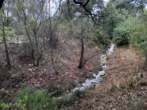
Finally, Gracely examined recent flood events in the channel through Westmont. “There was a very severe drought in Santa Barbara in 1990 followed by a very wet period, culminating in a flood event in 1995,” he says. “That 1995 flood through campus damaged a small pedestrian bridge and a road crossing on campus, but did not impact any of the residence halls, including Van Kampen, immediately adjacent to that channel. Likewise, even with the intense rainfall in January of this year, that channel going around VK and underneath that road carried the flood flow. In fact, most of the folks that were here on campus said it was a really unremarkable amount of water coming through that channel during the event.”
Also, the Westmont Creek, a small channel on west end of campus, did not flood in any severe way in rainfall that followed the 2008 Tea Fire, which destroyed 14 adjacent faculty homes.
Gracely also responded to questions about a map on the Santa Barbara County website, which included the Chelham Creek channel. “They marked the center line of the channel based on the topography to indicate the channel exists and that people should be aware of the channel’s presence in any flooding event,” he says. “But it’s not based, to our knowledge, of any hydrologic or hydrologist’s assessment of the channel or upstream watershed.”