Post-Fire Flooding and Debris Flow Potential Storm Planning Update
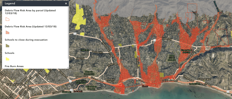
On Monday, December 3, 2018 the Santa Barbara County Office of Emergency Management released its updated evacuation planning map, clearly showing Westmont outside of the evacuation zone. We’re delighted that the Sheriff’s Department has given us the highest commendation for our shelter-in-place program. In the snapshot below, the campus is the larger yellow area to the right of the legend. Yellow identifies schools in this map; note Cold Spring School below Westmont. Neither appears in the darker yellow identifying a "school to close during evacuation." This means that county officials expect Westmont and Cold Spring to be safe from destructive flooding or debris flow.
Westmont will continue to cooperate with local law enforcement and emergency officials in monitoring storms and activating our SAFE Plan (Shelter Activated for Flood Emergencies) when necessary.
Watch a slideshow below developed in September 2018 with information that remains relevant about the safety of Westmont’s campus during a storm.


Click here for a narrative and graphic summary
of the September 2018 flood hazard analysis.